The Japanese military has repositioned a mobile radar unit to Yonaguni Island, Japan’s westernmost territory, in response to Chinese military activity in the region, Stars and Stripes reported on Monday.
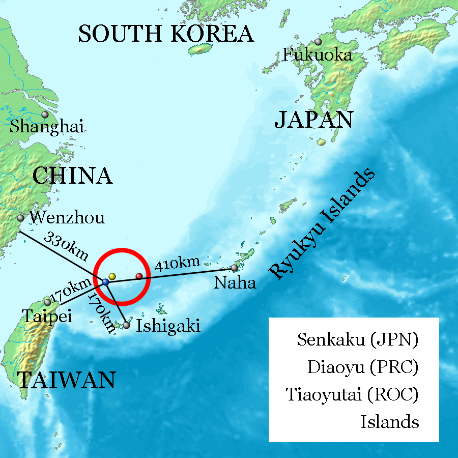
Japan sent 20 troops and a TPS-102 radar unit to the island, which is about 70 miles off Taiwan’s eastern coast and about 125 miles south of the Senkaku islands, or Diayous as they are known in China.
The Senkakus are Japanese-controlled uninhabited islands in the East China Sea that are also claimed by China and Taiwan. Tokyo often complains about Chinese coast guard vessels sailing near the Senkakus.
A Japanese military spokesman said that the radar unit was sent to the area to “strengthen the defense of our country at a time when neighboring countries are increasing their activities around our country.”
US officials have repeatedly told their Japanese counterparts that the US would intervene to defend the Senkakus if they come under attack. In his first call with Japanese Prime Minister Fumio Kishida, President Biden reaffirmed that the Article 5 mutual defense clause of the US-Japan Security Treaty applies to the Senkakus.
Why would China attack Senkakus? Why would anybody attack Senkakus? There is nothing there. Google maps satellite view shows no buildings or infrastructure of any type there. Nothing to attack, nothing to defend. Other than a radar unit just moved there. Would the U.S. really go to war over the Senkakus?????
Dear Mr.Dump:
You raise some very interesting (and relevant) questions, some I have pondered myself and the only thing I can respond with is WTF?!
I have heard it rumored, there is a kick-a– sushi bar, but I don’t think that is sufficient reason to go to war… But, you never know….
best-donna
P.A.T.R.I.O.T.S
we gave billions away to Japan to shop at our war store so they could have SDI controlled missiles for an economy of war.
It is our Peace Plan: Peace through Policing.
we also provide additional space-based radar to do the job. Stand-alone Radars need trained crews not armed guards and are outdated but make lovely false targets to chum some in. A lovely place to waste a warhead on, to spread thin the defensive and offensive weapons of China.
One less nuke coming here!
( the Chinese have Hypersonics too and P.A.T.R.I.O.T.S cannot touch them let alone target them). It is not even fair when the fur flies.
The best we can do is to watch the water vapor trails with sensitive satellites like we saw used to show us the asteroid that blew up over Russia a few years ago As It traveled through the mist. P.A.T.R.I.O.T.S are not designed for Hypersonic intercept.
China and Russia have had 40 years to perfect the Hypersonic SDI spoiler.
post Saudi attack modern solutions offer 360 degree radar coverage with 3 flat phased array antennas but most are only one array /120 degrees of coverage. We don’t rely on ground based radar reports any more. Saudi Arabia complained that that the combined drone and missile attack on their big refinery came from a direction they were not looking. It helped sell the Kurshner Peace Plan package with Spaz Farce monitoring 24/7 and able to launch any new version of P.A.T.R.I.O.T. online with a built in replenishment contract for more.
One 120 degree phased array radar unit would be sufficient to intercept any low and slow ICBM in the region especially those going to Australia who wants a piece of the Taiwan coastguard pie as soon as the launch ploom is detected and trajectory is determined: near instantly when working right with time to refresh data real time before intercept launch. It’s AI.
nice confusing map.
It needs more photoshop to work.
nothing matches the text, the map, the legend.
the color dots!
are not on the legend!
you use miles and the map is in KM.
interns!
put the corrected legend in the big blue void in the upper center and put a zoom picture in the lower right corner of the islands and use one or both metrics for distance if you want a passing grade this quarter.