Planet Labs says it will “indefinitely withhold” satellite visuals of Iran and the wider Middle East war zone after a request from the US government and the Trump administration. In an email to customers, the firm said it is shifting to a “managed distribution” model, releasing imagery only case-by-case for “urgent, mission-critical requirements,” or when release is deemed “in the public interest.” Planet also said it will withhold imagery dating back to March 9, and it expects the policy to remain in effect until the conflict ends.
On March 6, Planet Labs announced a mandatory 96-hour delay on new imagery collected over the Gulf states, arguing that near-real-time pictures could be exploited to “endanger allied, NATO, and civilian personnel.” That measure later expanded into a 14-day delay, described by Planet as an extension of the earlier hold. By March 30, Al Jazeera’s Digital Investigations unit was reporting that independent verification had become harder as commercial providers restricted satellite imagery.
Satellite imagery matters because, unlike press briefings, it can corroborate damage, assess patterns of targeting, and check narratives that would otherwise be accepted on authority. Reporting by the Global Investigative Journalism Network describes how open-source teams used satellite imagery and videos to probe contested incidents during this war, quoting Bellingcat’s head of research warning that a “two-week delay” slows verification and reduces the certainty investigators can reach while events are still developing. It also quotes the Defense Secretary saying, “Open source is not the place to determine what did or did not happen.”
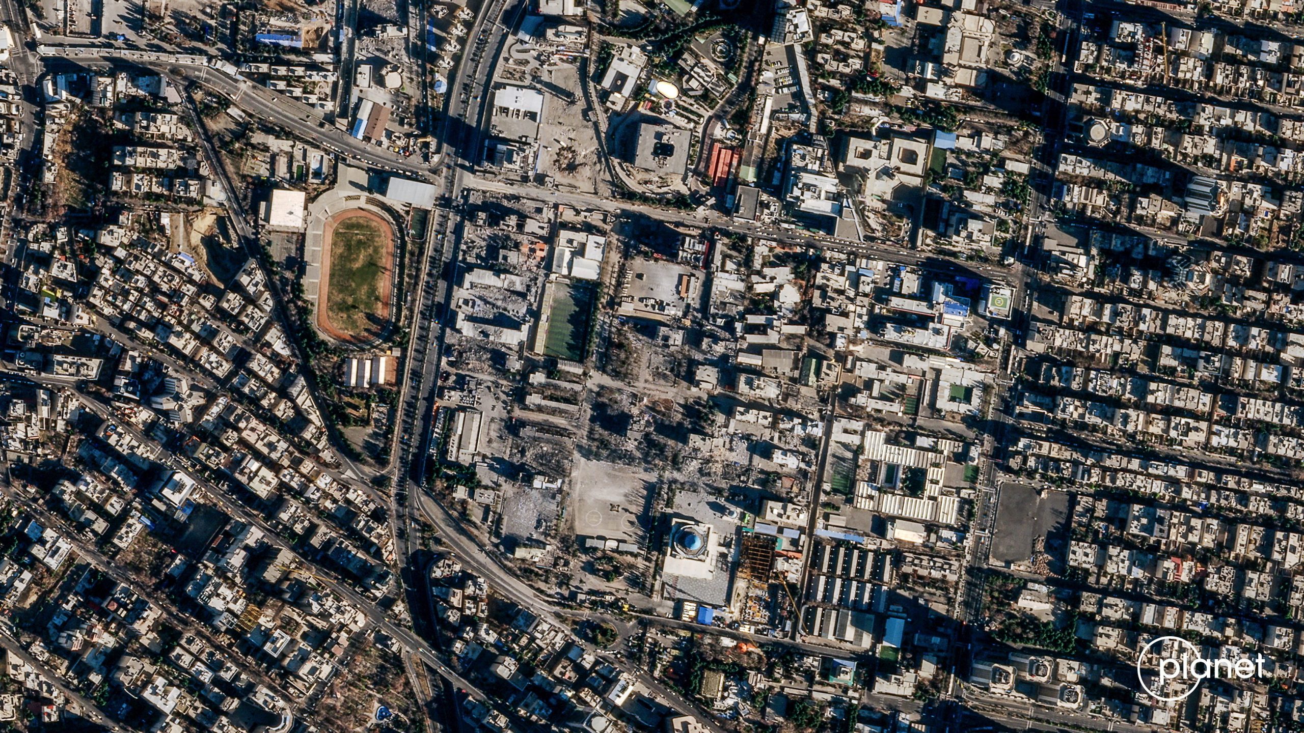
A satellite image shows Iran’s Law Enforcement Command (FARAJA) in Tehran, Iran, March 3, 2026, amid the US-Israeli conflict with Iran. 2026 Planet Labs PBC/Handout via REUTERS
Despite the insinuation that open source investigative journalism is less credible, even mainstream news organizations utilize such tools in their reporting. For example, Reuters has also used satellite imagery in its war coverage, including sharing said imagery and post-strike visuals with a munitions researcher in reporting on the strike on a girls’ school in Minab which killed over 170 people, mostly children. While later reporting added that the strike may have involved outdated targeting intelligence, it is worth noting that the president claimed “without evidence” that Iran was responsible.
One can concede that operational security is real and still recognize that “trust us” is an unsafe substitute for public evidence. In mid-March, the White House claimed Iran’s ballistic-missile capacity was “functionally destroyed,” with “complete and total aerial dominance,” while reporting in the same period described continued missile incidents and interceptions. But the Trump administration’s claim of total control over Iranian airspace seems dubious when countered with reports of military losses, such as the downing of multiple aircraft just since the start of April.
The blackout of satellite imagery from the region is not a story about one firm’s products or customer service. It is a reminder that foreign intervention tends to produce domestic control, often without the drama of a formal censorship order. The same state that wages war can narrow the evidence available to judge that war. The predictable result is that the public is pushed to take the word of the administration’s spokesmen at face value, without timely means to verify or falsify their claims.